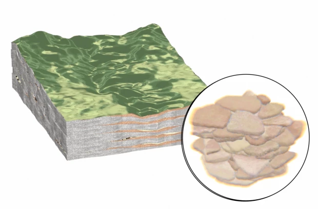
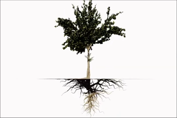
Trees embody their own multidirectional, hydrological system, which moves water downwards, upwards and laterally over the earth’s surface. The tree absorbs water through the root system which then channels the water through its structure, spreading from the roots, to the trunk, to the branches and finally to each leaf. The leaves release the water back into the atmosphere - through a process called transpiration. In this way, trees facilitate the movement of water upwards. This moisture will accumulate in the atmosphere before falling back to earth again as rain. Trees affect the flow of water laterally by acting as a barrier for flood waters which can lead to erosion and the movement of contaminants throughout the landscape, including seeping into the underground.
Trees also actively facilitate the movement of water downward into the subsurface. The root system produces macro-pores in the soil, this is a network of channels that moves water hundreds of times faster than the pores in the normal soil. In this way, roots increase infiltration rates, leading to faster recharge of aquifers. The leaves that fall on the ground and decompose into the soil improves the soil’s structure, which also increases infiltration rates. The root system also acts as a filter for water able to capture toxins and prevent them from reaching the aquifer. The tree canopy also provides a protective layer which shields the ground from the force of raindrops during storms, which can erode the soil. Tree roots from certain species can reach into groundwater, lifting the water into the upper layers of soil through a process called hydraulic redistribution https://doi.org/10.1007/s11104-021-05253-9">Belovitch MW, ST Brantley, and DP Aubrey. 2022. Interspecific variation in the timing and magnitude of hydraulic redistribution in a forest with distinct water sources. Plant and Soil 472: 451-464. https://doi.org/10.1007/s11104-021-05253-9, which occurs at night.
For all of these aspects of trees, it is generally agreed in the scientific community that they are important for the overall health of groundwater. In the WATEX report which mapped the probability of Costa Rica’s groundwater, the authors point to the rainforest as the most important asset to the country’s groundwater: “As it captures around 35 billion cubic meters of water annually, the Costa Rican rainforest is a crucial buffer zone that safeguards against soil erosion and runoff, thereby mitigating the risk of mudslides and floods. Regardless of the geological substrate, the rainforest must be considered the most valuable hydrogeological asset of Costa Rica.” WATEX Their claim is that regardless of what lies underground in terms of geological formation, the forest is the most important “hydrological asset” for the country.
If forests are a key hydrological asset, it is necessary to engage with the history of how they have been quantified and understood in Costa Rica. Forest cover maps were made in the years 1940, 1950 and 1961 by interpreting aerial photographs. The first remote sensing study of deforestation in the country was published in 1988 and argued that the national territory had less than 30% forest cover https://doi.org/10.2307/2388421.">Sader, Steven A., and Armond T. Joyce. “Deforestation Rates and Trends in Costa Rica, 1940 to 1983.” Biotropica 20, no. 1 (1988): 11–19. https://doi.org/10.2307/2388421.. Their study prompted what is now referred to as the “myth of Costa Rica’s deforestation” which was promoted globally by environmental organizations and the Costa Rican government. The myth gave way to a series of political and legal consequences that promoted conservation and slowed the country’s deforestation, even if the rate of deforestation experienced in the 20th century was under contention. For example, the National System of Conservation Areas (SINAC in its Spanish acronym) was created in 1989. This system divided the country into eleven different areas of conservation managed by the Ministry of the Environment and Energy (MINAE). Transferring much of the responsibility of administration of conservation into private hands.
Another remote sensing study in 1998 UCR, CCT & Fonafifo. (1998). Estudio de Cobertura Forestal Actual (1996/97) y de Cambio de Cobertura para el Periodo entre 1986/87 y 1996/97 para Costa Rica. San José: Centro de Investigaciones en Desarrollo Sostenible. produced more moderate estimates of deforestation between 1960 and 1986, which was then backed-up by a later study published in 2015, which demonstrated that national forest cover never fell below 40 percent Arturo Sánchez Azofeifa, “Análisis de La Cobertura Forestal de Costa Rica Entre 1960 y 2013,” Ambientico 253 (2015): 4–11.. While this estimate differs from the 1986 study which produced “the myth”, Azofeifa still describes this time period between 1960 and 1986 as one of significant forest loss, where forest cover dropped from 59.5 percent to 40.8 percent. He highlights a second time period, between 1986 and 2010, which can be defined as a period of recuperation and recovery, where forest cover rose to 51.4 percent. Significantly, Azofeifa cautions us to not only measure forest cover as an “extent” upon a territory but rather to consider its ecological quality.

Because a forest is not only trees. A forest is its whole diversity of species. The small plants, mosses, vines, and lichens that create the forest’s architecture. Forest Law No. 4465, enacted in 1969, defines a forest as “all vegetal associations composed predominantly of trees and other woody vegetation.” This definition, focuses on trees as the essential element, reflects a quantitative, structural logic. The forest thus appears as a collection of trees and woody plants, without reference to ecological relationships, timeframes, or complex dynamics of forest ecologies.
In contrast, Forestry Law No. 7575, in effect since 1996, takes a more holistic approach. Its Article 3 distinguishes between “forest” and “forest ecosystem,” reflecting a concern for recognizing not just the plant composition but also the interactions among living beings over time. It defines the forest ecosystem as a network of plants and animals that “depend on each other throughout their lives,” reaching a balance “that, if not interrupted, will be maintained indefinitely.” A “forest,” for its part, is defined as a native ecosystem that covers at least two hectares, with mature trees of different species and ages, and more than sixty trees per hectare with a DBH (diameter at breast height) greater than 15 cm. This definition introduces more complexity into a forest’s structure but still places trees at the center of what constitutes a forest.
Both laws, despite differing approaches, maintain a conceptual reliance on trees as the primary criteria for defining a forest. This association, however, has been challenged from various perspectives. One of the most significant critiques comes from organizations like the World Rainforest Movement (WRM), which point out how the definition adopted by international bodies such as the FAO—and replicated in many countries—allows monoculture tree plantations to be classified as “forests” https://www.wrm.org.uy/es/publicaciones/engano-y-destruccion-detras-de-la-definicion-de-bosque-de-la-fao.">Movimiento Mundial por los Bosques Tropicales, ed., “Engaño y Destrucción Detrás de La Definición de Bosque de La FAO,” World Rainforest Movement, March 21, 2018, https://www.wrm.org.uy/es/publicaciones/engano-y-destruccion-detras-de-la-definicion-de-bosque-de-la-fao.. This definition, they argue, not only obscures the ecological and social differences between a native forest and a plantation, but also creates problematic incentives, namely, that companies can access conservation or climate compensation funds for maintaining or expanding non-native monocultures, while native ecosystems are degraded.
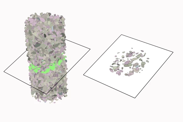
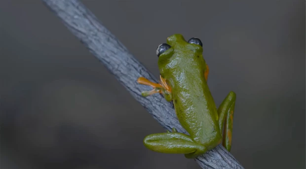
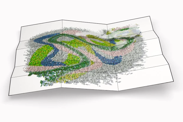
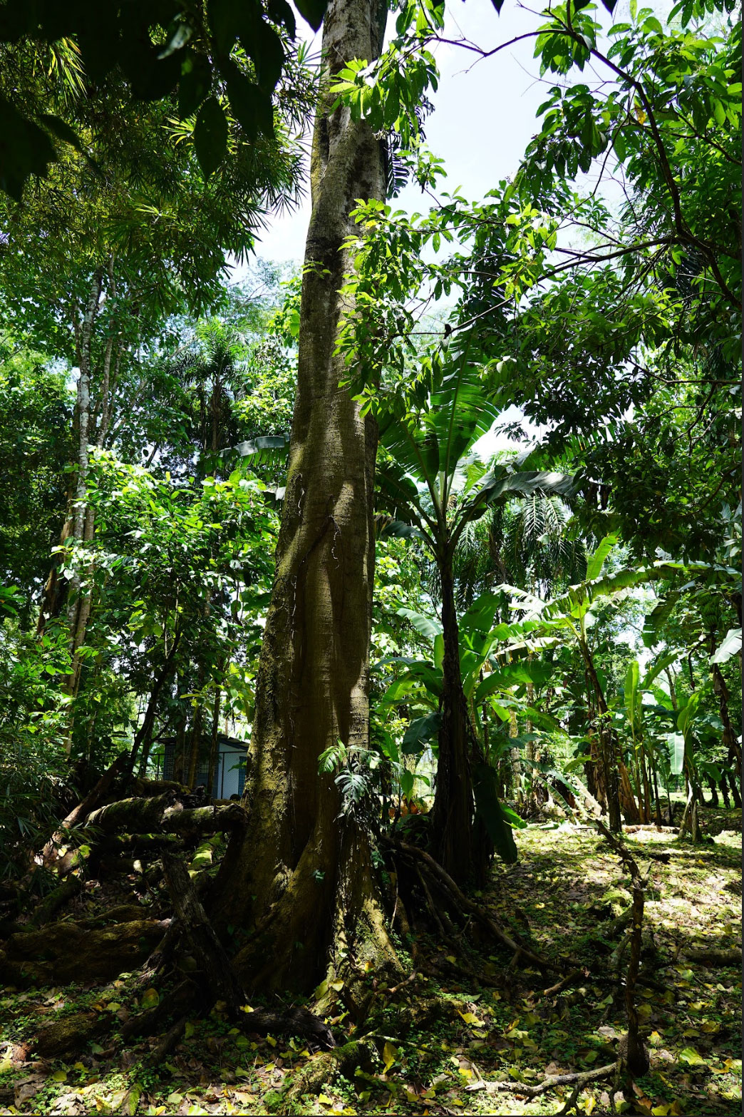
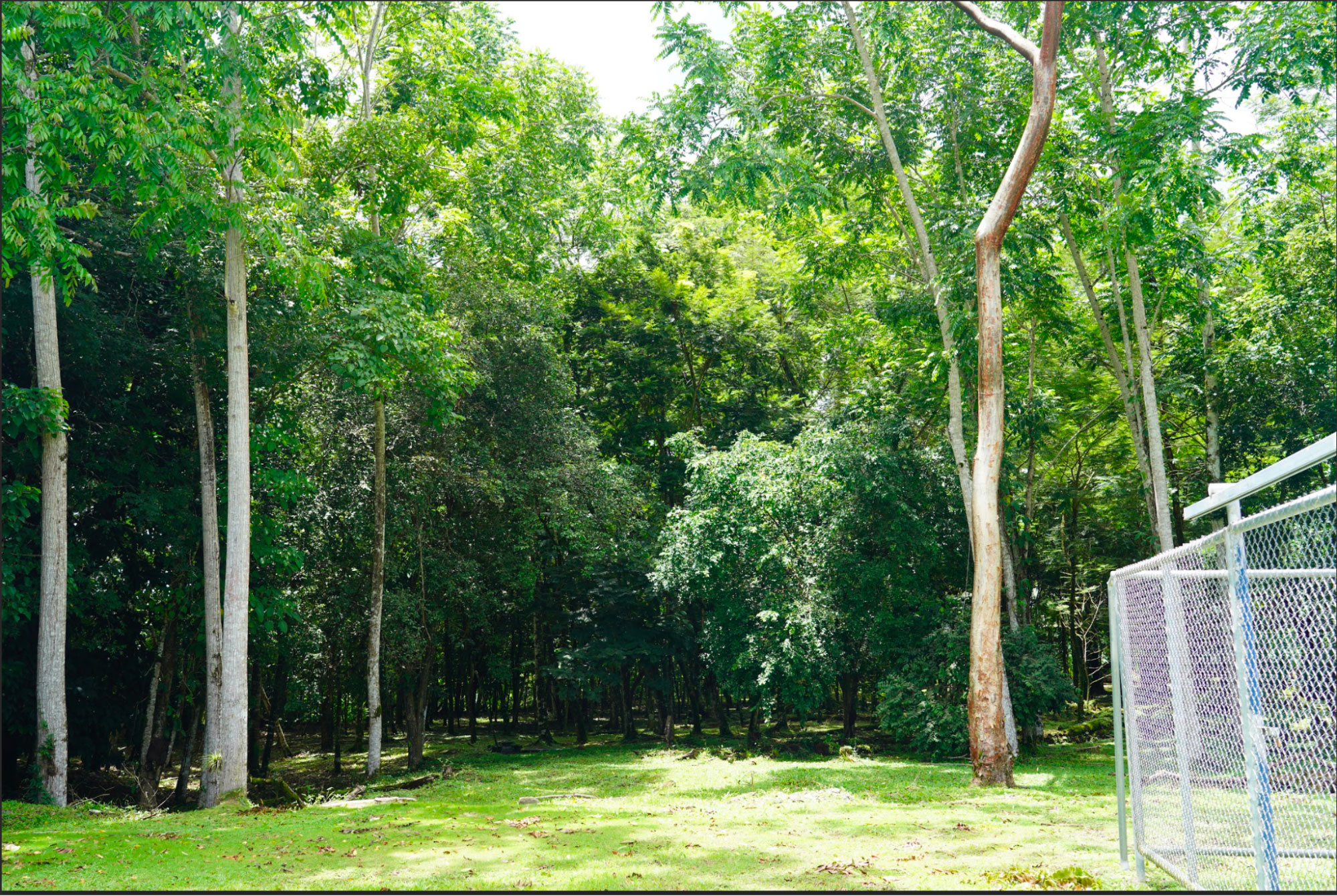
This perspective of a forest as a complex diverse entity that goes beyond the singular tree informed the film recording that we undertook in Río Blanco. We were interested in the world around the tree. The insects that made their home in the crevices, the frogs that clung to their roots, the great vines that wrapped around the whole structure, sometimes obscuring where the tree began and ended. When recording the trees in Río Blanco, different angles were chosen for the shots: looking downwards, looking upwards, looking at the tree from our human vantage point, some five feet above the ground. These shots are compiled above to convey the forest’s diversity, and put this in dialogue with the world under our feet.
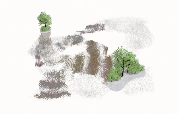
The importance of trees, and the forest more generally, to the aquifer in Río Blanco is widely recognized. In the image above trees are planted around two wells of the ASADA in Río Blanco, providing a buffer for flooding or potential contamination from reaching the wells. In our conversations thinking about the future of this area in relation to the aquifer, many residents spoke about the importance of conservation of the forests, including the forest in the mountains which feeds the aquifer over which they live. One resident described the urgency to put in place measures to prevent further deforestation in the area of the aquifer’s recharge:
ll that forested area in the upper zone is extremely important. And it’s urgent to take preventive measures, right? So that it doesn't continue being logged, that deforestation doesn't continue, and that a regeneration project can be proposed for all those areas that are already deforested — because that’s what needs to be done in order to protect the aquifer of the subbasin. These are the recharge zones, and if we don’t have the recharge zone protected, what we’re going to face in the coming years is widespread sedimentation due to erosion, right?
While trees and deforestation is often thought of in the past tense - in relation to a forest already lost, here, the concern is orientated towards a future possibility, one where the tree and the presence of the forest is directly related to the future of water in the region. In this way the tree becomes a powerful mediator for the underground, able to conjure multiple futures.