Pamphlet One

Authors list

Kate Lewis Hood

Postdoctoral Research Associate

Kate Lewis Hood was a Postdoctoral Research Associate on the Smart Forests project. Kate completed an interdisciplinary environmental humanities PhD from Queen Mary University of London, which considered how Black and Indigenous poetic and spatial practices address watery places transformed by colonialism and racial capitalism in Turtle Island/North America and the Pacific islands. Kate is interested in how colonial logics, practices, and geographies endure in watery and forest environments, and how creative methods contribute to their contestation and reimagining.

Introduction

Introduction subtitle goes here

[Big text] The Smart Forests Atlas is a living archive and virtual fieldsite exploring how digital technologies are transforming forests.

[Text] The Smart Forests Atlas is a research platform developed through the Smart Forests research project, which investigates the social-political impacts of digital technologies that monitor and govern forest environments. Our research project considers how forests and technologies are co-constituted. Rather than advocate for smartness, we question how and why forests are becoming technologically optimised to address environmental change.

[Heading 1]

[Heading 2]

[Heading 3]

[Heading 4]

[Heading 5]
[Heading 6]
  • [List]
  • List item 1
  • List item 2
  • List item 3 List item 3 List item 3 List item 3 List item 3 List item 3 List item 3 List item 3 List item 3 List item 3
  • List item 4
  • [Numbered list]
  • List item 1
  • List item 2
  • List item 3 List item 3 List item 3 List item 3 List item 3 List item 3 List item 3 List item 3 List item 3 List item 3
  • List item 4

[Text] The Smart Forests Atlas is a research platform developed through the Smart Forests research project, which investigates the social-political impacts of digital technologies that monitor and govern forest environments. Our research project considers how forests and technologies are co-constituted. Rather than advocate for smartness, we question how and why forests are becoming technologically optimised to address environmental change.

OpenForests

Added 03/28/2022

3Logbook

Contributors
  • Max Ritts
Tags
  • restoration
  • sensors
  • smart environments
  • surveillance

OpenForests is a Germany-based technology firm that develops digital tools for forest restoration and conservation initiatives, often led by NGOs and state institutions. Operating in over 50 countries worldwide, OpenForests is best known in the environmental services sector for elaborating and networking a map-based project communication platform, explorer.land.

explorer.land

explorer.land
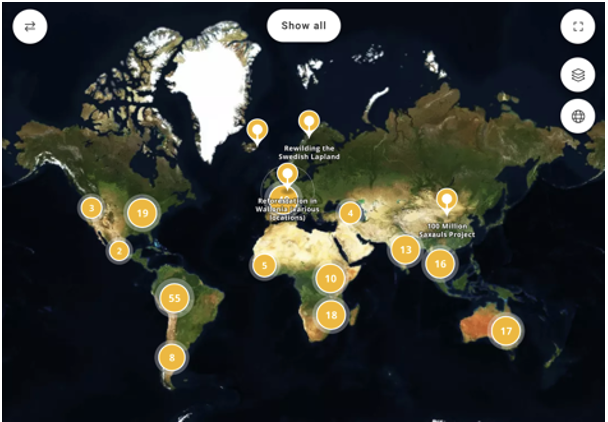
Overview of explorer.land map. Image source: explorer.land [map]. Retrieved 26 March 2022, from https://explorer.land/x/projects

explorer.land is a map platform and storytelling tool for organisations looking to share their landscape projects with stakeholders (including investors and donors) and the wider public. The platform allows organisations to upload multimedia content documenting their projects, along with high-resolution satellite and drone imagery.

Yurok Tribe Environmental Program

Added 07/13/2022

4Logbook

Contributors
  • Kate Lewis Hood
Tags
  • carbon
  • fire
  • forest fire
  • forest management
  • Indigenous communities
  • Indigenous science
  • monitoring
  • wildfire

The Yurok Tribe, from the Klamath River Basin, is the largest federally recognised tribe in what is currently called California, with over 5000 enrolled members. Since 2013, the Yurok Tribe has negotiated participation in the California Air Resources Board (CARB)'s cap-and-trade program for carbon offsetting, using the carbon sequestration of their forested lands to obtain carbon credits. With the income generated through their participation in the programme, the Yurok Tribe has bought over 60,000 acres of previously dispossessed land, and developed the Yurok Tribe Environmental Program that implements Yurok forest management approaches (including controlled burns) and habitat restoration in the Klamath River watershed.

Yurok Tribe Carbon Offsetting

The Yurok Tribe established the first forest carbon offset project under the California Compliance Offset Protocol. For each metric ton of carbon the Yurok Tribe can prove its forests have sequestered from the atmosphere, CARB issues an offset credit, which polluting industries can then buy in order to comply with the state’s greenhouse-gas-emissions cap.

In order to participate in the carbon market, the Yurok Tribe has used a range of mechanisms and funding sources to buy back ancestral lands from a large timber company. As Manning and Reed (2019) document, these mechanisms have included partnerships with a conservation non-profit, federal loans, New Market Tax Credits (NMTCs), and financing from the Australian green investment company New Forests. The Yurok have increased their land base to over 100,000 acres, and used carbon offset income for a range of ecological restoration projects, including the Yurok Tribe Fire Department that helps to tackle forest fires and implements controlled burns in the redwood forests using Yurok Traditional Ecological Knowledge. However, the Yurok's participation in the scheme has created debate among members around ways of negotiating (settler colonial) state regulation and governance structures, and complicity with ongoing resource extraction and pollution. Since the Yurok Tribe started participating, thirteen other tribes and Alaska Native corporations have become involved in California’s cap-and-trade program, and collectively receive around half of all forest offset credits issued through the scheme.

Although the cap-and-trade program largely uses on-the-ground fieldwork for assessing and verifying carbon sequestration, in 2022, the Yurok Tribe received a $5 million grant from the US Department of Commerce for an aircraft equipped with high-resolution environmental mapping, LiDAR, and aerial imaging technologies. The aircraft will be used in the Yurok's environmental restoration programmes and to develop contract mapping, data collection, and analysis services for government agencies, nonprofits, and private businesses, building capacity for Indigenous data sovereignty in Yurok lands.

California Condor (Prey-go-neesh) Livestream

YurokTribe_CondorFeed
The California condor (prey-go-neesh) A1 prior to being released. Image source: Yurok Tribe [image]. Retrieved 13 July 2022, from https://www.yuroktribe.org/post/nccrp-sets-release-date-for-fourth-and-final-member-of-first-condor-cohort

One impact of the Yurok Tribe's reacquisition of ancestral land has been facilitating the reintroduction of the prey-go-neesh/California condor through the Northern California Condor Restoration Program (NCCRP) in partnership with Redwood National and State Parks. The prey-go-neesh is important to Yurok cosmologies and efforts to restore the ancestral forest ecosystem. Viewers can access a live feed of the condors, the first of which were released in May 2022.

Indigenous Forest Technologies, Digital Practices, and Data Sovereignty

Added 12/22/2024

5Story

Contributors
  • Kate Lewis Hood
  • Jennifer Gabrys
Tags
  • art
  • carbon
  • community-led systems
  • data sovereignty
  • deforestation
  • Indigenous communities
  • Indigenous science
  • land use
  • mapping
  • monitoring
  • NFTs
  • offsetting
  • podcasts
  • restoration
  • seed collectors
  • seed technologies

"Through the reacquisition of forestlands, the [Yurok] Tribe is engaging in forestry practices guided by traditional knowledge and contemporary scientific knowledge with the goal of restoring the forestlands to a dynamic ecosystem the forest once knew and allowing Yurok Tribal members to interact with the landscape as they have done since time immemorial."

Frankie Myers (Vice Chairman, Yurok Tribe), Testimony Regarding Natural Solutions to Cutting Pollution and Building Resilience, US Congress, October 2019
Screen Shot 2022-07-28 at 10.31.12

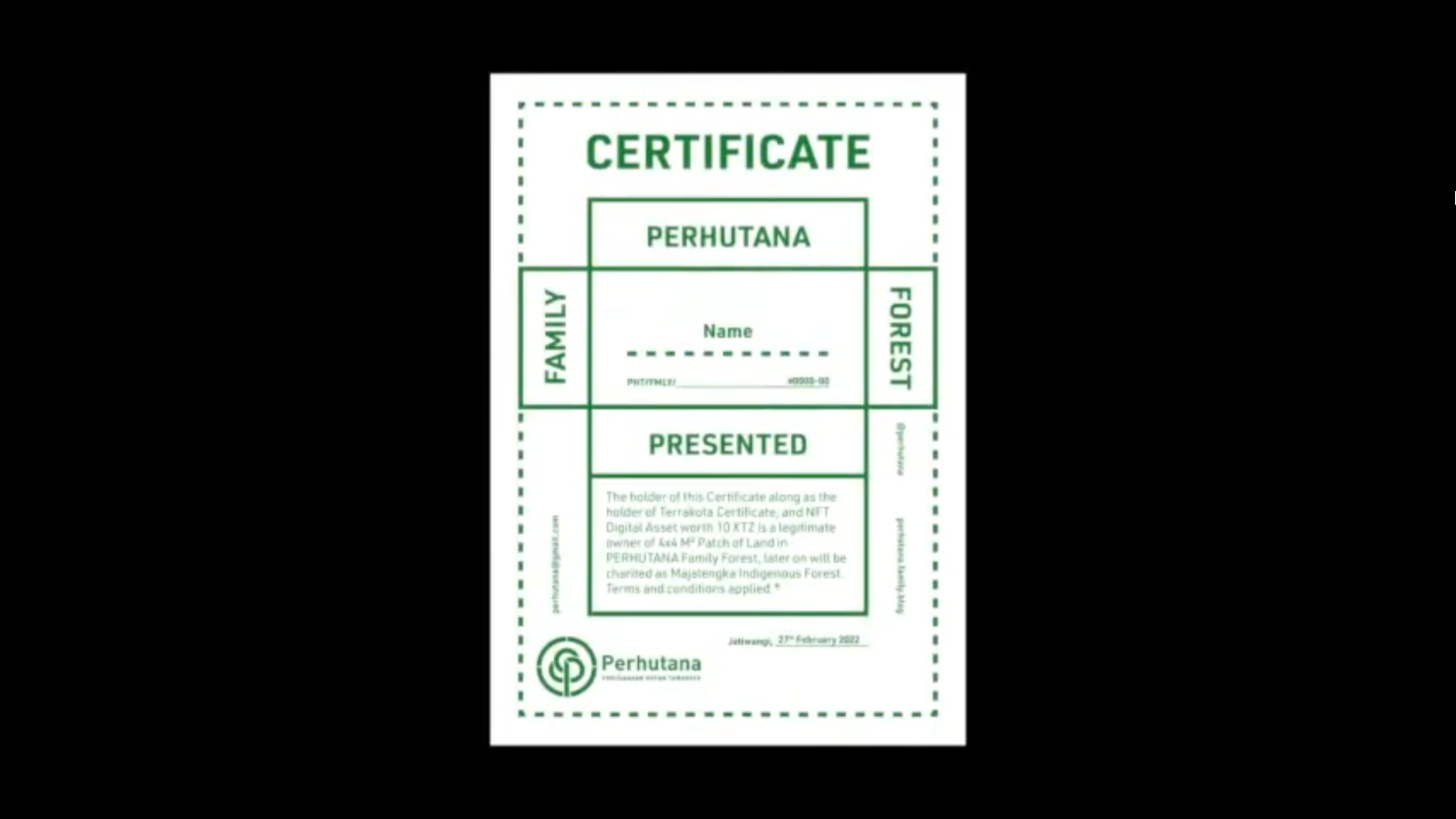
Screengrab from the Perhutana promotional video, showing a forest certificate for investing in the forest. Image source: Jatwiangi Art Factory [screengrab]. Retrieved 13 July 2022, from https://www.youtube.com/watch?v=vScXg4BUur8

Indigenous peoples, local communities, and social and environmental organisations are combining forest knowledges developed over generations with emerging digital modes of communication, mapping, and monitoring in order to build capacity for self-determination in forest governance and relation in the context of ongoing colonialisms and environmental change. The examples in this story sustain and adapt longstanding forest practices and socio-ecological relations variously through digital platforms, GIS mapping, aerial imaging, and NFTs. They mobilise these technologies towards land, data, and epistemic sovereignty against persistent and renewed forms of dispossession and environmental injustice. These projects reveal the complex, often contradictory processes of navigating uneven state, neoliberal, and Indigenous modes of environmental governance in Indigenous and community efforts to reclaim and restore more-than-human forest environments.

Cosmopolitical forests

In a forthcoming article, Smart Forests researchers propose a cosmopolitical approach to forests that attends to the multiplicity of beings, stories, and socio-technical practices that constitute ways of knowing and inhabiting forests as pluralistic assemblages. The article builds on scholarship that presents forests as political entities constituted through territorial governance strategies and technologies of measurement, classification, and calculation. As Indigenous scholars and activists have argued, such modes of datafication have often been operationalised for the material and epistemic containment and extraction of Indigenous lands, bodies, and knowledges (Tuhiwai Smith, 1999). In this context, the Indigenous projects discussed in this story highlight different modes through which technologies materialise multiple, uneven and frictional forest worlds.
Xingu Seed Network

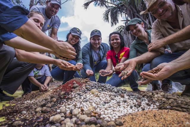
Practitioners prepare the mix of seeds for land restoration through direct seeding through the Xingu Seed Network. Image source: Tui Anandi [photograph]. Retrieved 11 April 2022.

Forests as networks / infrastructures of restoration

The Xingu Seed Network started as a grassroots initiative led by Indigenous communities and local farmers in southeast Amazonia/north Brazil for collecting and supplying native seeds for landscape restoration. The network involves over 500 seed collectors, many of them women, and promotes knowledge sharing around seed collection practices and technologies. In a region undergoing high rates of deforestation, seed production offers alternative forms of income generation to agricultural expansion, logging, and mining. There are now multiple seed networks in Brazil, and the digital platform Redário facilitates communication and coordination between them.

In the forests of the Klamath River Basin in California, the Yurok Tribe has used different strategies to support environmental restoration and Indigenous sovereignty. In 2013, the Yurok Tribe negotiated participation in the State of California’s cap-and-trade carbon offsetting scheme, and with the income from carbon credits bought over 60,000 acres of previously dispossessed ancestral lands from a timber company. They also developed an Environmental Program that implements Yurok forest management approaches (including controlled burns) and habitat restoration in the Klamath River watershed. The carbon financing of this work has raised some debate among tribal members concerning complicity with polluting and extractive industries, but the Yurok Tribe’s approach has offered a model for reclaiming land that has since been taken up by multiple Native nations across North America. The Yurok Tribe has recently been supported by a $5 million grant from the US Department of Commerce to support the use of high-resolution environmental mapping, LiDAR, and aerial imaging technologies in their environmental restoration programme.
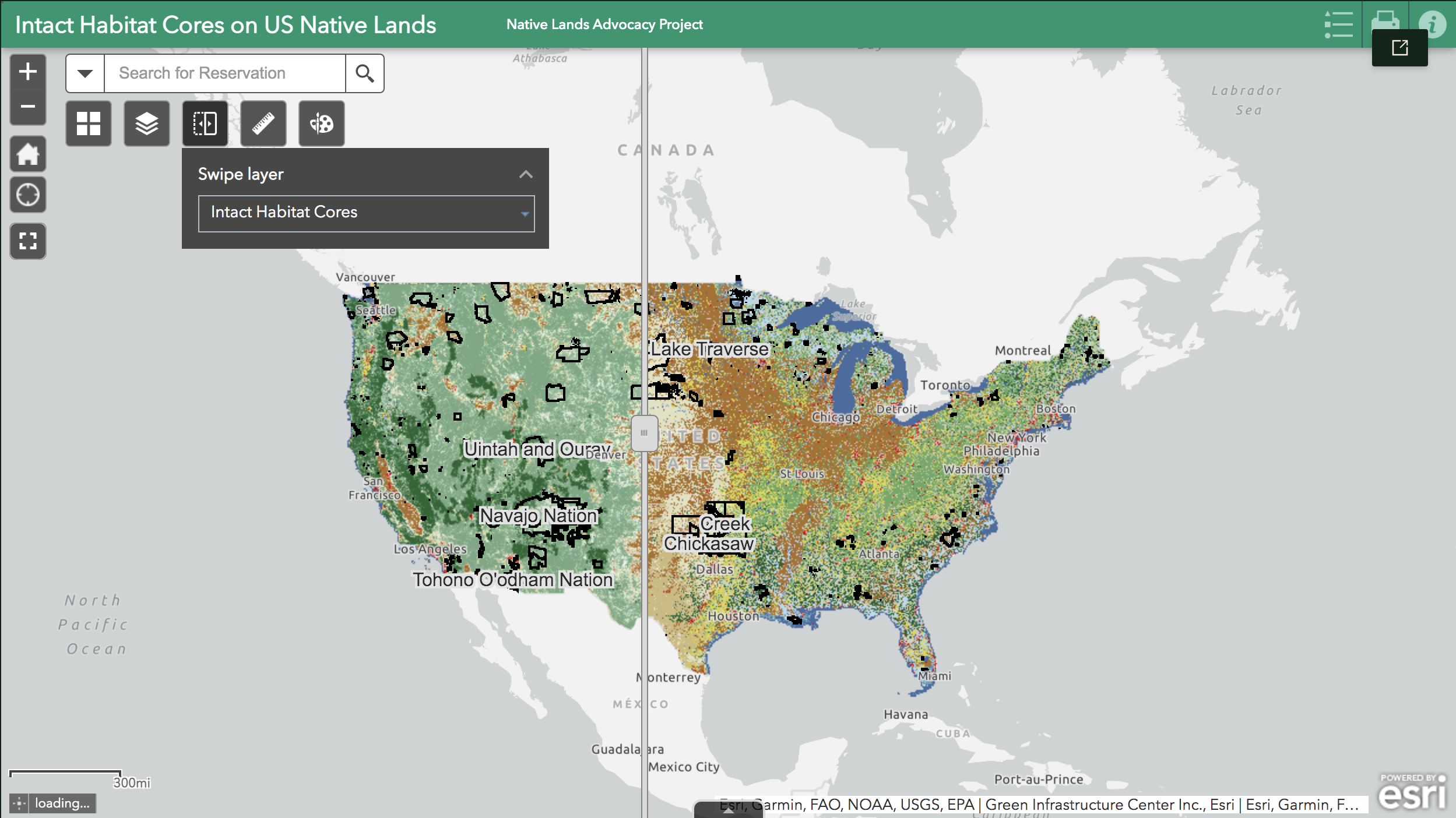
NLAP_IntactHabitatMap

Screenshot of the Preserving Intact Habitat on US Native Lands map. Image source: Native Lands Advocacy Project [screenshot. Retrieved 13 July 2022, from https://nativeland.info/blog/storymaps/preserving-intact-habitat-on-us-native-lands/

Environmental mapping, monitoring, and data sovereignty

Indigenous communities are using monitoring tools to map the impacts of resource extraction, land grabs, environmental degradation and climate change in forest environments. In the Amazon, platforms such as the System for Observation and Monitoring of the Indigenous Amazon (SOMAI) and the Amazonian Network of Georeferenced Socio-Environmental Information (RAISG) gather environmental data on deforestation, land use, infrastructure, and socio-environmental threats such as fire and drought, providing information and political tools to support Indigenous organisations and demands. In the place currently known as the United States, the Native Land Information System (NLIS) offers mapping and data tools for Tribes and Native communities, with the aim of supporting habitat protection and restoration through Indigenous frameworks of relation to land. A central element of NLIS’s work is building Indigenous data sovereignty, emphasising governance over the collection, ownership, and use of data. For example, a recent storymap proposes generating data on Native lands in term of "Intact Habitat Cores" rather than the more well-known framework of Key Biodiversity Areas, because Indigenous peoples have often not been part of consultation processes around KBAs.
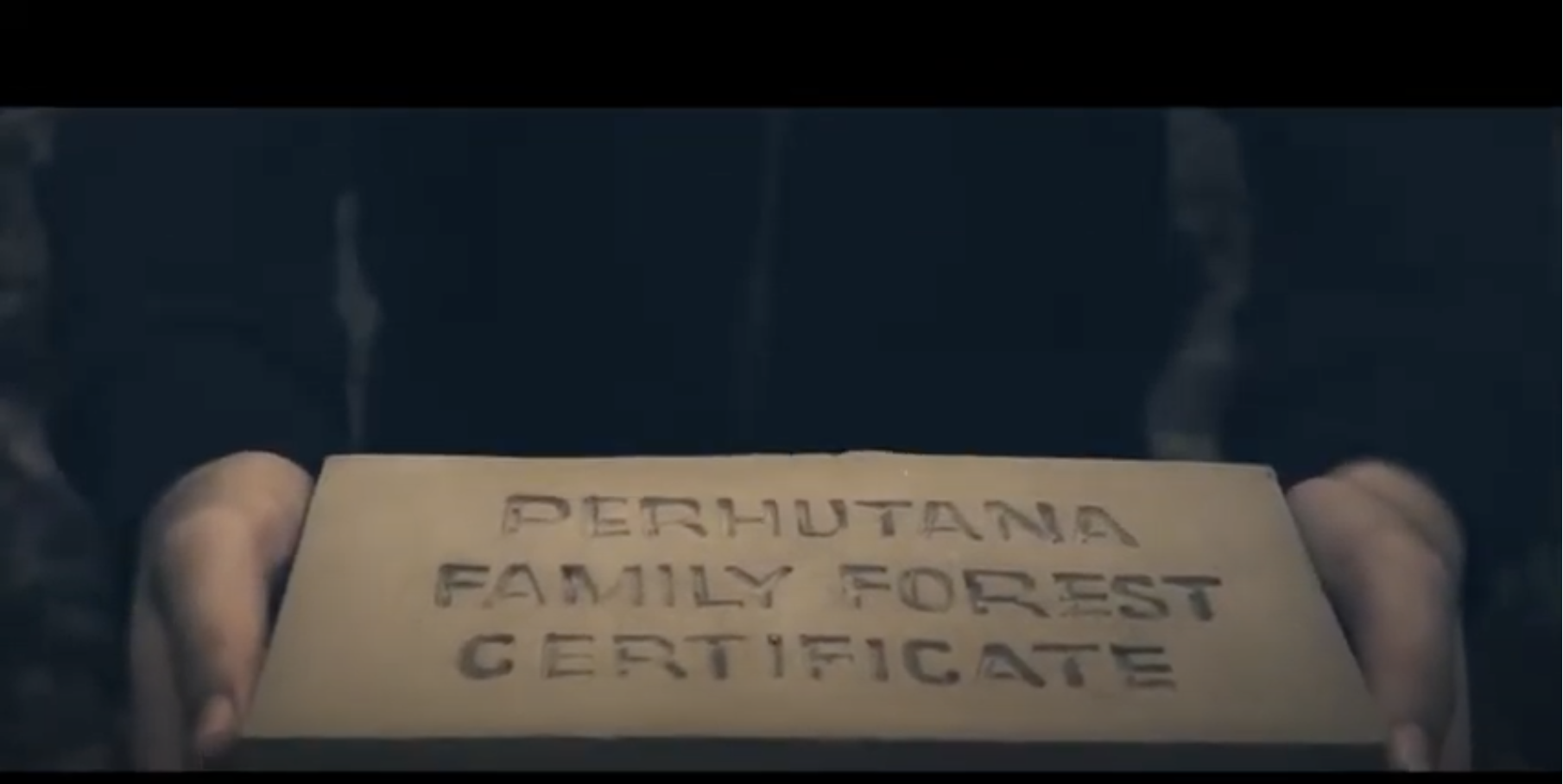
PERHUTANA_ForestCertificate

Screengrab from the Perhutana promotional video, showing a soil brick certificate for investing in the forest. Image source: Jatwiangi Art Factory [screengrab]. Retrieved 13 July 2022, from https://www.youtube.com/watch?v=vScXg4BUur8

Mobilising community through Indigenous media, arts and social practice

Finally, Indigenous and traditional communities are utilising a range of media to communicate and build networks around Indigenous environmental knowledges, cultures, and political struggles. Examples include community-led podcasts in Brazil, such as Copiô, Parente!, which communicates how federal political decisions impact Indigenous territories, and Povos e Comunidades Tradicionais do Brasil (Brazil’s Traditional Peoples and Communities), which shares local leaders’ thoughts and oral histories around land struggles and community mobilisations.

In West Java, Indonesia, Perhutana is a social forestry project that plans to reclaim 8 hectares of land in the Majalengka district as conservation forest for the people living there. The project operates on the basis of investment into forest plots, using NFTs to certify ownership of plots to be later donated to the community forest. Perhutana was launched by the arts collective Jatiwangi art Factory at the international art festival documenta Fifteen, which took place in Germany in 2022, and was also shared online. Moving across political and aesthetic terrains, multiple knowledges and technologies, Perhutana attempts to address ongoing dispossession and environmental change through engaging with but also exceeding neoliberal state frameworks of understanding and calculating forest value.

For more on cosmopolitical forests, look out for the forthcoming article:

Gabrys, Jennifer, Michelle Westerlaken, Danilo Urzedo, Max Ritts, and Trishant Simlai. (2022). "Reworking the Political in Digital Forests: The Cosmopolitics of Socio-Technical Worlds." Progress in Environmental Geography, 1(1–4). https://doi.org/10.1177/275396872211178.

How Digital Platforms Transform Global Forest Restoration Actions

Added 12/22/2024

6Story

Contributors
  • Danilo Urzedo
  • Kate Lewis Hood
  • Michelle Westerlaken
  • Jennifer Gabrys
Tags
  • automation
  • community-led systems
  • land degradation
  • land use
  • mapping
  • monitoring
  • networks
  • platform
  • restoration
  • seed collectors
  • seed technologies
  • tree planting

The emergent use of digital technologies for reversing land degradation reveals critical equity and justice concerns.

A growing number of digital technologies are increasingly aligned with an international target of restoring 350 million hectares of degraded lands by 2030. Our recently published research article in the journal Environmental Politics examines how digital platforms influence power dynamics in restoration activities. A wide range of digital devices and techniques promise a new paradigm for restoring hundreds of millions of hectares of degraded lands worldwide. Examples include digital systems for mapping degraded landscapes, robotics for tree planting, and mobile applications for plant species identification and selection for restoration. At the same time, our recent assessment discloses how digital platforms influence restoration decision-making processes that can create or exacerbate unequal power dynamics in knowledge production, financing, and market arrangements.

As part of a global search, we identified and tested 55 digital platforms applied to restoration activities to understand their operations. These platforms include multi-user databases, geospatial mapping and planning, smartphone applications, games, blockchain systems, crowd-funding networks, and social media. You can find the complete list of the selected digital platforms here. By analyzing these platforms, we identified four social-political drivers of technological developments. You can learn more about each of them below.

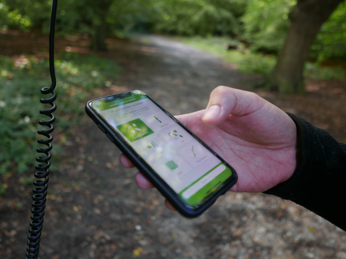
Plant Identification App

A mobile application for plant species identification. Photo: Jennifer Gabrys

Scientific knowledge to optimize forest restoration operations

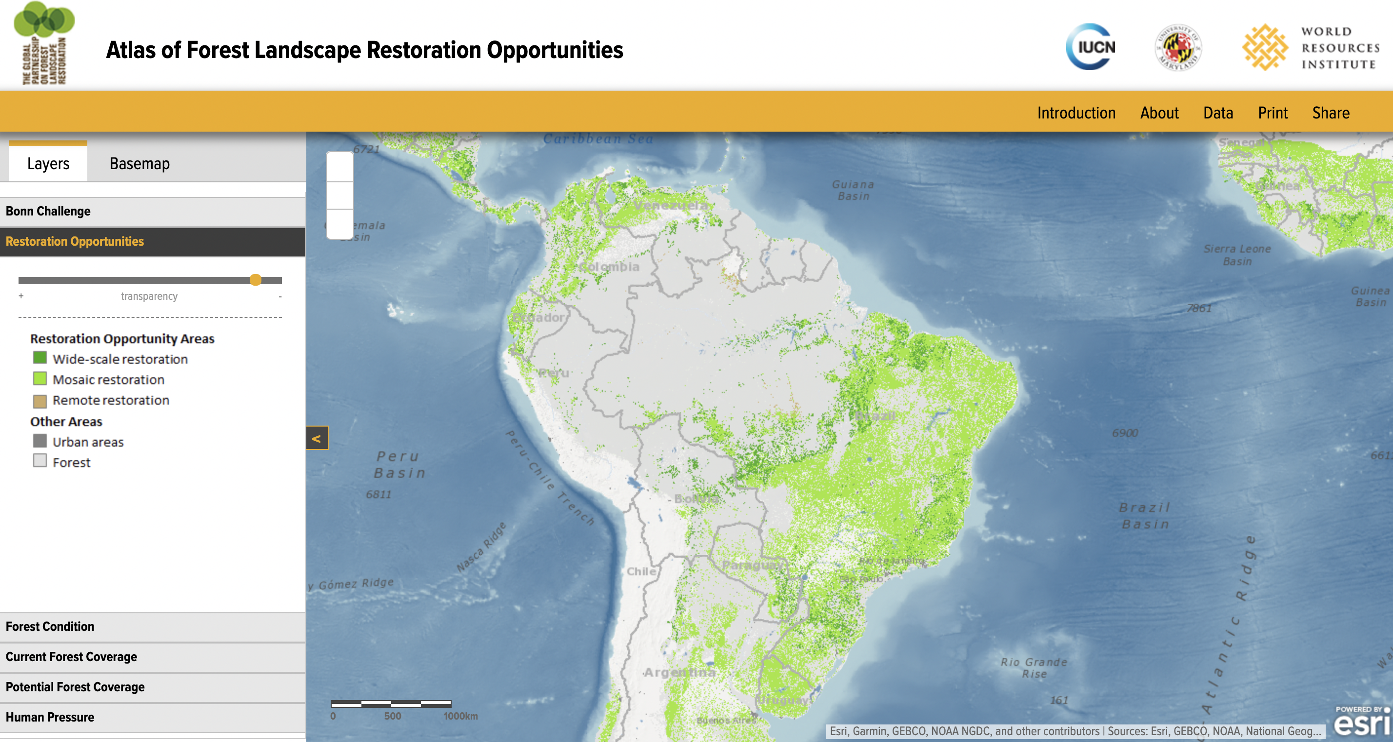
This first digital development driver highlights scientific knowledge's role in maximizing tasks to implement ambitious international restoration goals and policies. Scientific expertise for restoration produces and organizes technologies to predict scenarios, select feasible methods, and create supposedly cost-effective interventions. For instance, international environmental NGOs launched the Atlas of Forest and Landscape Restoration Opportunities in 2011 to identify priority degraded lands to be restored globally. Another example is the Framework for Ecosystem Restoration Monitoring, a geospatial platform that measures the progress of restoration actions. Even though these digital platforms may help accomplish international pledges, these developments often fail to incorporate local knowledge and place-based issues to plan where and how restoration should be undertaken.

Screenshot of Atlas of Forest Landscape Restoration Opportunities interactive map. Image source: World Resources Institute Atlas of Forest Landscape Restoration Opportunities website. Retrieved 23 June 2022, from https://www.wri.org/applications/maps/flr-

Screenshot of the Atlas of Forest Landscape Restoration Opportunities interactive map. Image source: The World Resources Institute Atlas of Forest Landscape Restoration Opportunities website. Retrieved 23 June 2022, from https://www.wri.org/applications/maps/flr-atlas/

Global digital networks for capacity building

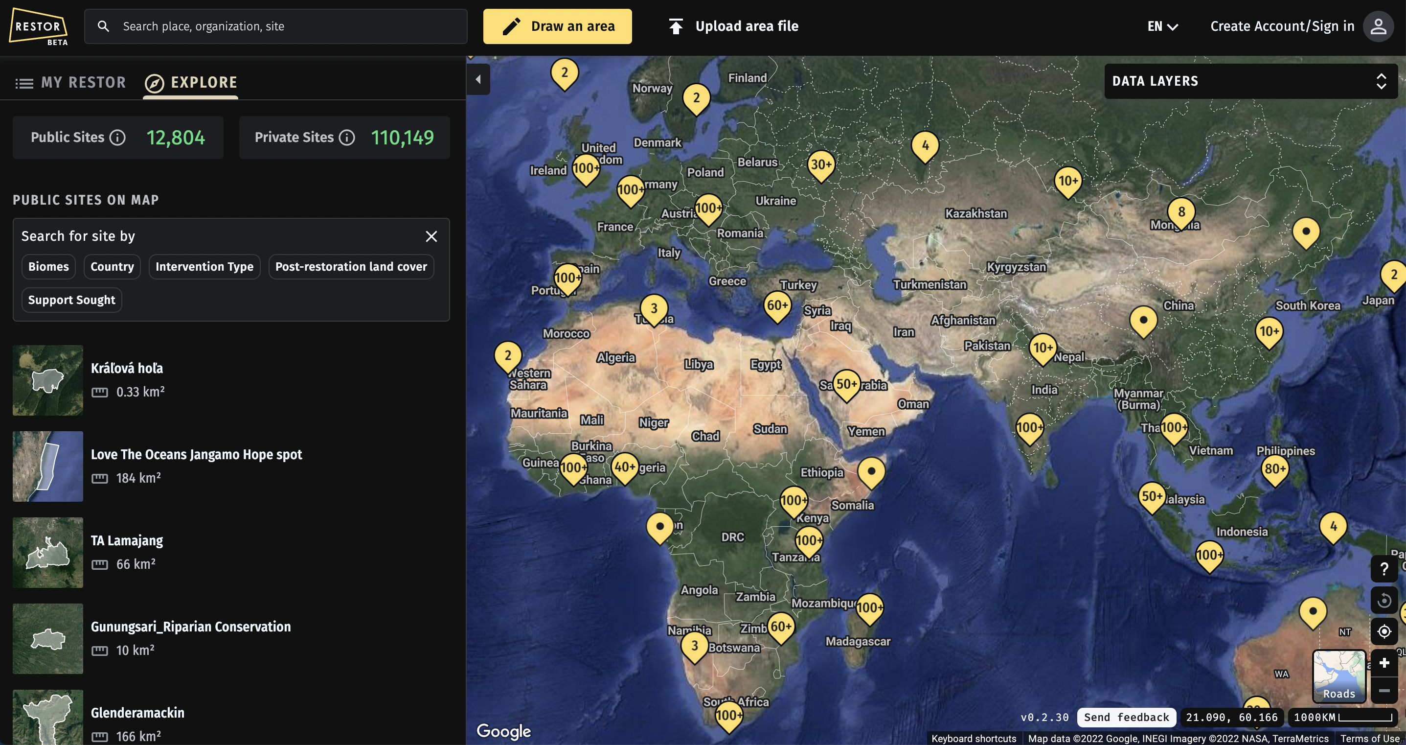
In the form of collaborative channels, these capacity-building networks interconnect diverse stakeholders for data collection, resource exchange, and communication. These digital networks seek to decentralize information, promote collaboration, and support access to financial resources for restoration projects. For instance, the Restor platform is a digital network that connects practitioners and organizations running restoration actions worldwide. The Land Accelerator program is another example of an international channel to connect multiple stakeholders in order to mobilize resources for projects at the local level. These platforms offer tools for managing systems and resources to support decision-making processes, which further generate specific models and arrangements for restoration actions. At the same time, there are several ethical and sovereignty issues on how these systems enforce particular practices and use data, particularly when these datasets are applied to develop carbon markets, for example.

Screenshot of Retor. Image source: Restor website. Retrieved 23 June 2022, from https://restor.eco/

Screenshot of the Restor platform. Image source: Restor website. Retrieved 23 June 2022, from https://restor.eco/

Digital tree-planting markets to operate restoration supply chains

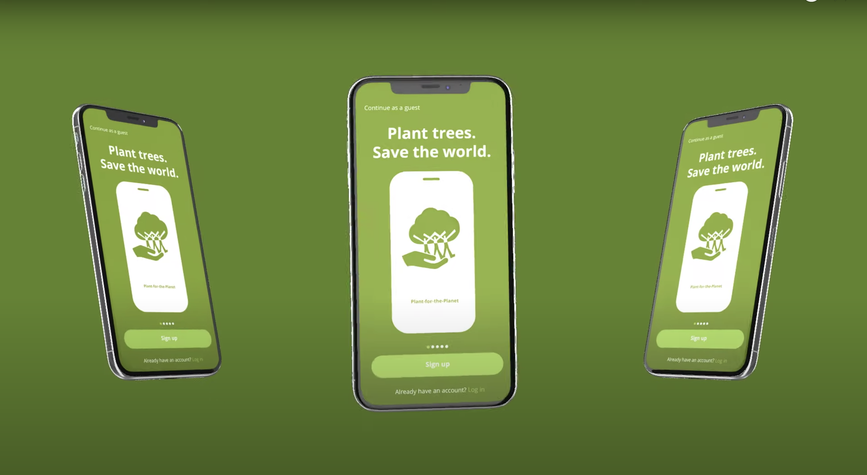
Our study also identified emerging restoration markets that are materializing through digital supply chains that link stakeholders with tree-planting commercial arrangements. Through digitally enabled networks, the British online platform, TreeApp, supports planting hundreds of thousands of trees yearly. This mobile application encourages users to engage with advertisements from several brands to generate credits for tree planting across 14 projects in the Global South. These digital restoration platforms create easy-to-use infrastructures for individuals and companies to offset carbon emissions. Still, they commonly present a potential disconnect with actual restoration practices on the ground, which could work to develop meaningful livelihood improvements and transparent restoration actions.

Screenshot of the Tree App's website. Image source: TreeApp. Retrieved 23 June 2022, from https://www.thetreeapp.org/

Screenshot of the Treeapp's website. Image source: Treeapp. Retrieved 23 June 2022, from https://www.thetreeapp.org/

Community participation in digital co-creation of restoration practices

Digital platforms are also a critical component of diverse grassroots restoration initiatives and practices of community stakeholders in everyday experiences. Community-led restoration actions adopt digital platforms to improve communication processes between local stakeholders to activate and mobilize regional restoration networks. These restoration groups and community networks are, for example, present on social media to share practices, lessons, and struggles that help share experiences and improve restoration actions. In Brazil, a partnership between community-based seed suppliers led to the formulation of Redário, a national platform to assist regional restoration networks. Redário has co-produced a seed supply management platform to coordinate commercial operations of seed suppliers with restoration markets. Notably, the co-creation process is not a simple participatory activity and may not always include the diversity of local values, interests, and financial goals.

These four different drivers of technological developments highlight how digital platforms can shape restoration projects. This study suggests the need for critical attention to these emerging environmental technologies to comprehend how knowledge and expertise are coded into the politics of platforms. Such platform-led restoration actions can contribute to and amplify inequality issues when implementing restoration initiatives across scales.

For more information, you can access the full open-access article at:

Urzedo, Danilo, Westerlaken, Michelle, and Gabrys, Jennifer. "Digitalizing Forest Landscape Restoration: A Social and Political Analysis of Emerging Technological Practices." Environmental Politics. DOI: 10.1080/09644016.2022.2091417.

Credits

For more information on the Smart Forests project, contact Prof Jennifer Gabrys.

Follow us on Twitter for the latest updates on the Smart Forests project and the Planetary Praxis research group.

This project has received funding from the European Research Council (ERC) under the European Union’s Horizon 2020 research and innovation programme (Grant Agreement No. 866006).

The Smart Forests Atlas is free to use for non-commercial purposes (with attribution) under a CC BY-NC-SA 4.0 license. For more information, please read our licence.

Thanks to…

Number of copies: 1000
Fonts: Monaco, Marr
Design process: web to print, API, pagedjs
Graphic design: Angeline Ostinelli and Sarah Garcin