Protected Area

SmartForestsBook

2023.05.22 V1

Protected Area

Table of contents

Introduction

The Forest Ecology and Conservation Group (or Coomes Lab) is a team of researchers in the Conservation Research Institute and the Department of Plant Sciences at the University of Cambridge. The group uses high-resolution remote sensing to understand how forests are responding to global environmental change, with projects exploring forest biodiversity, conservation, and ecological dynamics. Research from the group also contributes to the University of Cambridge Centre for Earth Observation.

Industry/Forestry 4.0

2Logbook

Contributors
  • Kate Lewis Hood
Tags
  • automation
  • forestry 4.0
  • industry 4.0
  • internet of things

Research and development in the forestry industry (especially in northern European and Canadian contexts), increasingly explores how processes of digital automation in the Industry 4.0 paradigm can be implemented and expanded in forest environments for a range of economic and environmental purposes.

FPInnovations Forestry 4.0

The Canadian forestry private not-for-profit organisation FPInnovations is researching and developing techniques for Forestry 4.0 automation in forest operations. Forestry 4.0 is primarily oriented towards enhancing the Canadian forest industry, but is also framed in terms of improving sustainability and environmental performance.

FPInnovations Forestry 4.0

Screengrab from a promotional video for Forestry 4.0. Image source: FPInnovations [screengrab]. Retrieved 28 September 2022, from https://www.youtube.com/watch?v=r4vhLQ8OEP0

The Forestry 4.0 research and development (R&D) programme aims to tackle challenges in the forest industry such as labour shortages and problems with connectivity in remote forest operations through technological solutions. Involving collaborations with academic institutions and private companies, the initiative proposes to develop internet connectivity in forest environments, bringing together real-time data from satellite imagery, remote sensing, and LiDAR to build detailed forest inventories. The programme is also developing autonomous trucks and harvesting devices using remote sensing and robotics.

What are the terms in which technological initiatives such as Forestry 4.0 envision a more sustainable forest economy? What are the tensions between industrial value creation and other ways of valuing forests, and how what role do processes of datafication play in mediating these tensions?

SmartForest

SmartForest is a Norway-based consortium of industry partners and research institutions that seeks to develop and implement digital technologies to increase efficiency, precision, and value in the forest sector. Across different areas such as forest data production, precision forestry, and supply chain traceability, SmartForest use a range of technologies including remote sensing, drones, and AI and deep learning algorithms. Bringing these approaches together, the centre has developed ForestSens, a cloud-based platform that processes sensor data from forest environments and other data along the value chain, and applies AI algorithms for analysis.

SmartForest

A graphic showing how SmartForest uses technology across different forest industry areas. Image source: SmartForest [screenshot]. Retrieved 4 May 2023, from https://smartforest.no/wp-content/uploads/2023/03/SmartForest-Annual-Report-2022.pdf

In its outward presentation, SmartForest strongly emphasises networks connecting industry and research, both within Norway and with international partners including FPInnovations (Canada) and Mistra Digital Forest (Sweden). To what extent do these collaborative networks facilitate multiple (including critical) perspectives on forest industry innovation and the ways that value is constituted and distributed in the forest sector (and forest environments more broadly)?

Mistra Digital Forest

Mistra Digital Forest is a programme that connects research on digital technologies to the Swedish forest industry. The programme is funded by Mistra, the Swedish Foundation for Strategic Environmental Research, and seeks to embed emerging digital technologies in a forest sector that has previously emphasised tradition. Unlike other examples in this logbook, Mistra Digital Forest does not explicitly reference the Industry 4.0 paradigm, focusing more on sustainable development using technologies including lasers, remote sensing, and robotics.

Forest Data Partnership

3Logbook

Contributors
  • Kate Lewis Hood
Tags
  • big data
  • big tech
  • datafication
  • geospatial
  • monitoring
  • restoration

The Forest Data Partnership was launched at COP26 in 2021 by the World Resources Institute (WRI), the Food and Agriculture Organization of the United Nations (FAO), USAID, the US Department of State, Google, NASA, and Unilever. The partnership seeks to develop a "consistent geospatial data ecosystem" that allows for accurate monitoring of forest loss and restoration.

Forest Data Partnership: Technologies and Participation

The Forest Data Partnership proposes to bring together remote sensing and machine learning technologies with cloud infrastructure to offer open-source, validated geospatial data on forests that governments, companies, NGOs, and communities can use to tackle deforestation and facilitate and verify restoration projects. The partnership involves SERVIR, a joint geospatial initiative between NASA, USAID, and geospatial organisations in Asia, Africa, and Latin America, Google as the provider of the Forest Data Partnership platform and other technologies, and Unilever as coordinator of private sector involvement.

Forest Data Partnership

A graphic of the Forest Data Partnership's approach to data. Image source: Forest Data Partnership [graphic]. Retrieved 16 May 2023, from https://www.forestdatapartnership.org/data-approach

In its current phase (launched at COP27), the Forest Data Partnership is inviting participation from companies involved in cocoa, palm oil, soy and cattle supply chains that risk contributing to forest loss, along with forest/natural resource management bodies, technology partners, local communities and NGOs in tropical regions. How will this ambitious project use data to engage (and potentially align) this diverse range of stakeholders, especially amidst context-specific tensions, differences, and uneven distributions of power between them? And does a "consistent data ecosystem" preclude a space for multiple, perhaps variably systematic knowledges?

How Digital Platforms Transform Global Forest Restoration Actions

4Story

Contributors
  • Danilo Urzedo
  • Kate Lewis Hood
  • Jennifer Gabrys
  • Michelle Westerlaken
Tags
  • automation
  • community-led systems
  • land degradation
  • land use
  • mapping
  • monitoring
  • networks
  • platform
  • restoration
  • seed collectors
  • seed technologies
  • tree planting

The emergent use of digital technologies for reversing land degradation reveals critical equity and justice concerns.

A growing number of digital technologies are increasingly aligned with an international target of restoring 350 million hectares of degraded lands by 2030. Our recently published research article in the journal Environmental Politics examines how digital platforms influence power dynamics in restoration activities. A wide range of digital devices and techniques promise a new paradigm for restoring hundreds of millions of hectares of degraded lands worldwide. Examples include digital systems for mapping degraded landscapes, robotics for tree planting, and mobile applications for plant species identification and selection for restoration. At the same time, our recent assessment discloses how digital platforms influence restoration decision-making processes that can create or exacerbate unequal power dynamics in knowledge production, financing, and market arrangements.

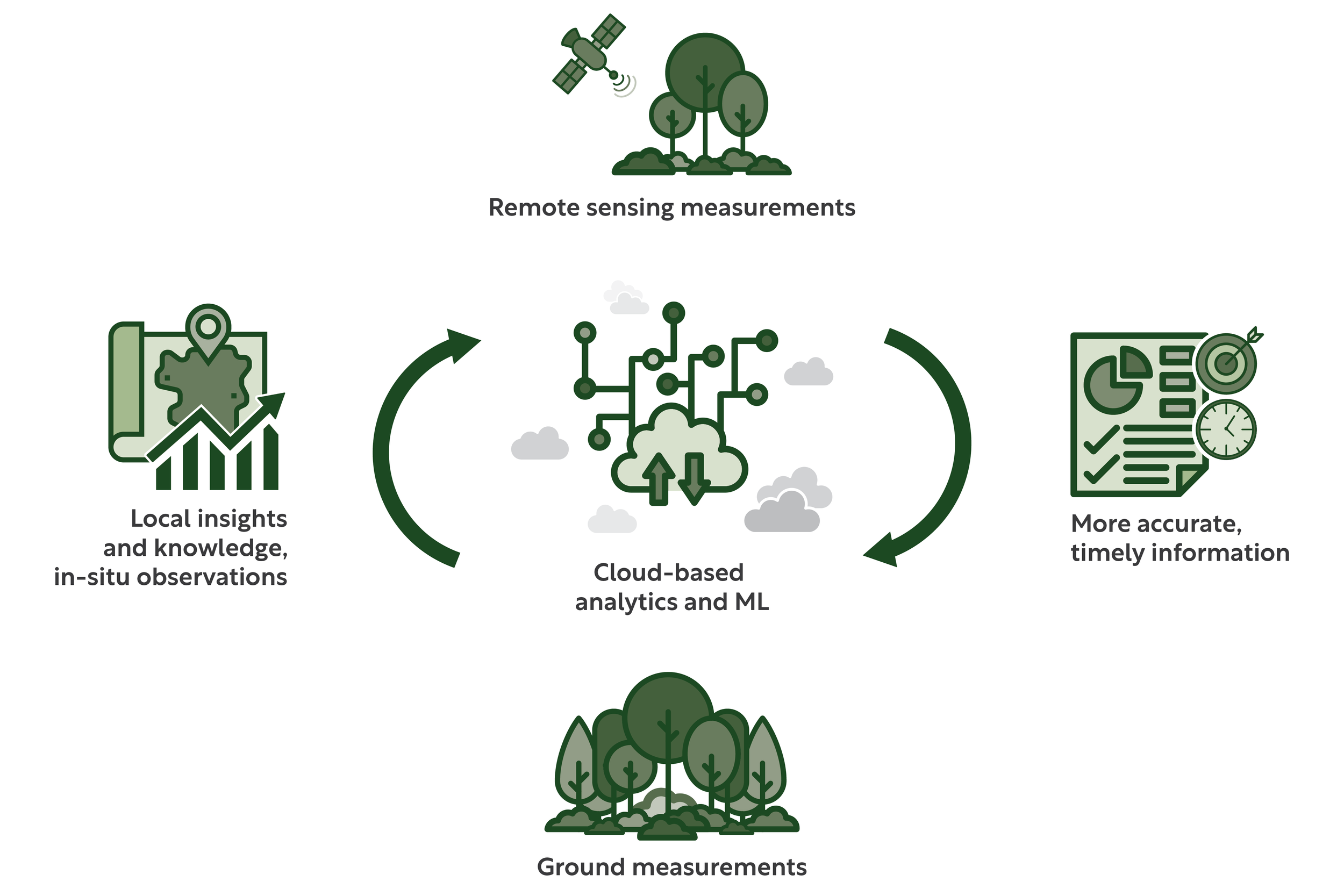
As part of a global search, we identified and tested 55 digital platforms applied to restoration activities to understand their operations. These platforms include multi-user databases, geospatial mapping and planning, smartphone applications, games, blockchain systems, crowd-funding networks, and social media. You can find the complete list of the selected digital platforms here. By analyzing these platforms, we identified four social-political drivers of technological developments. You can learn more about each of them below.

Plant Identification App

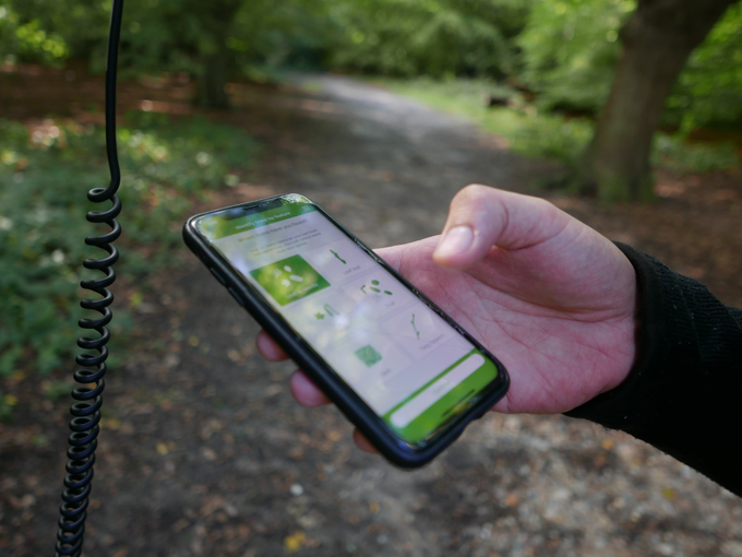
A mobile application for plant species identification. Photo: Jennifer Gabrys

Scientific knowledge to optimize forest restoration operations

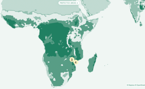
This first digital development driver highlights scientific knowledge's role in maximizing tasks to implement ambitious international restoration goals and policies. Scientific expertise for restoration produces and organizes technologies to predict scenarios, select feasible methods, and create supposedly cost-effective interventions. For instance, international environmental NGOs launched the Atlas of Forest and Landscape Restoration Opportunities in 2011 to identify priority degraded lands to be restored globally. Another example is the Framework for Ecosystem Restoration Monitoring, a geospatial platform that measures the progress of restoration actions. Even though these digital platforms may help accomplish international pledges, these developments often fail to incorporate local knowledge and place-based issues to plan where and how restoration should be undertaken.

Screenshot of Atlas of Forest Landscape Restoration Opportunities interactive map. Image source: World Resources Institute Atlas of Forest Landscape Restoration Opportunities website. Retrieved 23 June 2022, from https://www.wri.org/applications/maps/flr-

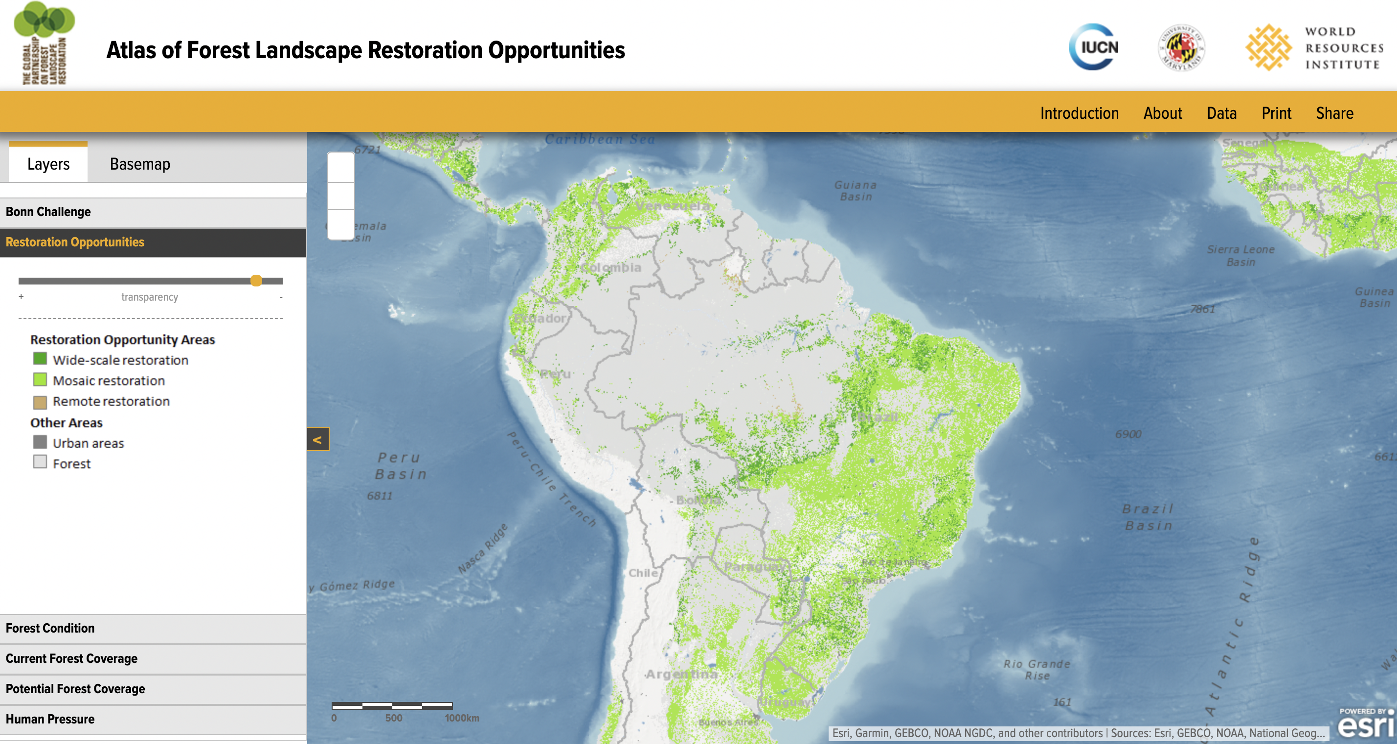
Screenshot of the Atlas of Forest Landscape Restoration Opportunities interactive map. Image source: The World Resources Institute Atlas of Forest Landscape Restoration Opportunities website. Retrieved 23 June 2022, from https://www.wri.org/applications/maps/flr-atlas/

Global digital networks for capacity building

In the form of collaborative channels, these capacity-building networks interconnect diverse stakeholders for data collection, resource exchange, and communication. These digital networks seek to decentralize information, promote collaboration, and support access to financial resources for restoration projects. For instance, the Restor platform is a digital network that connects practitioners and organizations running restoration actions worldwide. The Land Accelerator program is another example of an international channel to connect multiple stakeholders in order to mobilize resources for projects at the local level. These platforms offer tools for managing systems and resources to support decision-making processes, which further generate specific models and arrangements for restoration actions. At the same time, there are several ethical and sovereignty issues on how these systems enforce particular practices and use data, particularly when these datasets are applied to develop carbon markets, for example.

Screenshot of Retor. Image source: Restor website. Retrieved 23 June 2022, from https://restor.eco/

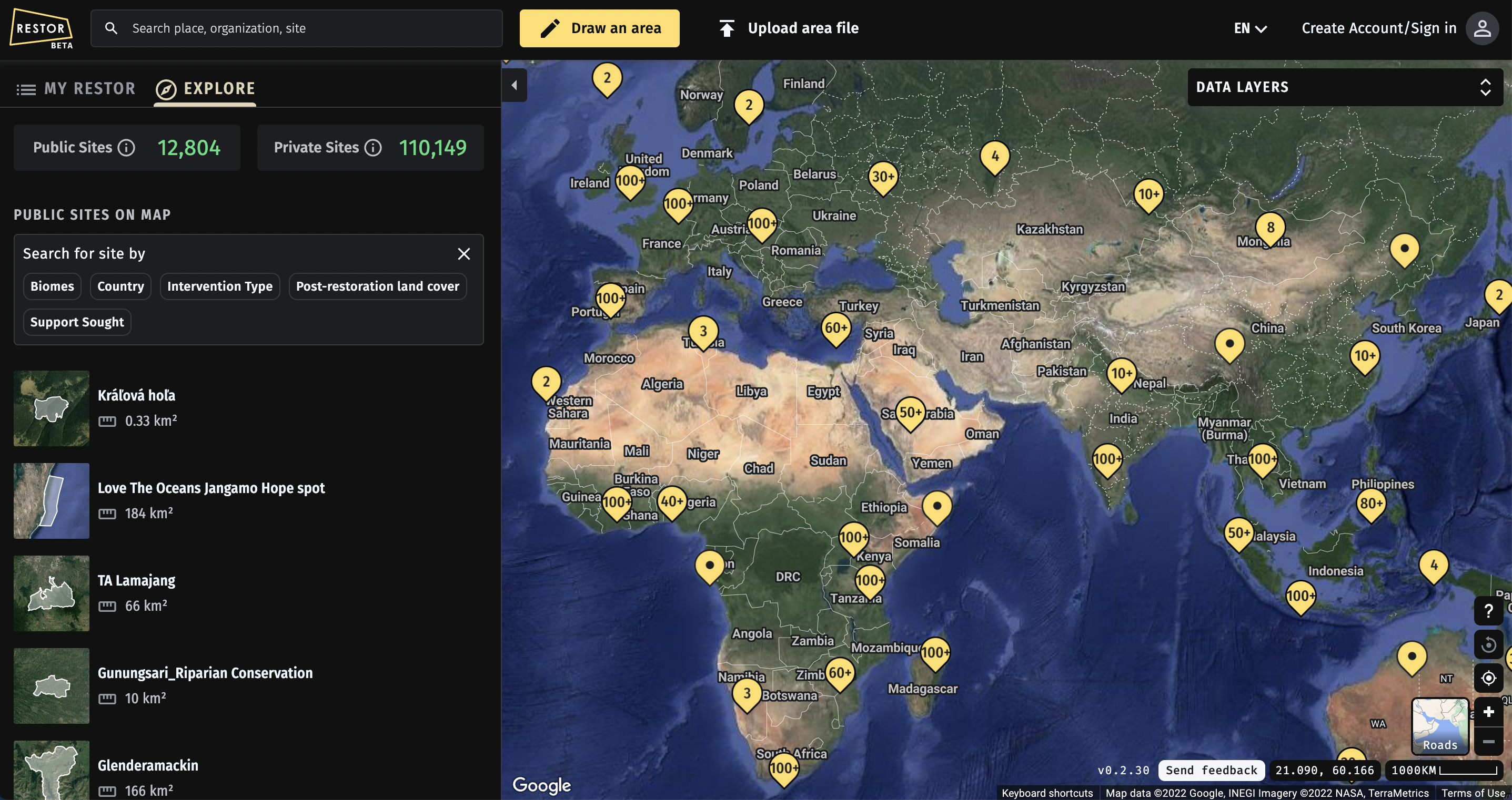
Screenshot of the Restor platform. Image source: Restor website. Retrieved 23 June 2022, from https://restor.eco/

Digital tree-planting markets to operate restoration supply chains

Our study also identified emerging restoration markets that are materializing through digital supply chains that link stakeholders with tree-planting commercial arrangements. Through digitally enabled networks, the British online platform, TreeApp, supports planting hundreds of thousands of trees yearly. This mobile application encourages users to engage with advertisements from several brands to generate credits for tree planting across 14 projects in the Global South. These digital restoration platforms create easy-to-use infrastructures for individuals and companies to offset carbon emissions. Still, they commonly present a potential disconnect with actual restoration practices on the ground, which could work to develop meaningful livelihood improvements and transparent restoration actions.

Screenshot of the Tree App's website. Image source: TreeApp. Retrieved 23 June 2022, from https://www.thetreeapp.org/

Screenshot of the Treeapp's website. Image source: Treeapp. Retrieved 23 June 2022, from https://www.thetreeapp.org/

Community participation in digital co-creation of restoration practices

Digital platforms are also a critical component of diverse grassroots restoration initiatives and practices of community stakeholders in everyday experiences. Community-led restoration actions adopt digital platforms to improve communication processes between local stakeholders to activate and mobilize regional restoration networks. These restoration groups and community networks are, for example, present on social media to share practices, lessons, and struggles that help share experiences and improve restoration actions. In Brazil, a partnership between community-based seed suppliers led to the formulation of Redário, a national platform to assist regional restoration networks. Redário has co-produced a seed supply management platform to coordinate commercial operations of seed suppliers with restoration markets. Notably, the co-creation process is not a simple participatory activity and may not always include the diversity of local values, interests, and financial goals.

These four different drivers of technological developments highlight how digital platforms can shape restoration projects. This study suggests the need for critical attention to these emerging environmental technologies to comprehend how knowledge and expertise are coded into the politics of platforms. Such platform-led restoration actions can contribute to and amplify inequality issues when implementing restoration initiatives across scales.

For more information, you can access the full open-access article at:

Urzedo, Danilo, Westerlaken, Michelle, and Gabrys, Jennifer. "Digitalizing Forest Landscape Restoration: A Social and Political Analysis of Emerging Technological Practices." Environmental Politics. DOI: 10.1080/09644016.2022.2091417.

Australian Acoustic Observatory (A2O)

5Logbook

Contributors
  • Kate Lewis Hood
Tags
  • acoustics
  • big data
  • bioacoustics
  • monitoring
  • open data
  • phenology
  • sensors

The Australian Acoustic Observatory (A2O) is an acoustic sensor network operating in 90 sites across different ecoregions in Australia. The A2O collects long-term environmental acoustic data that are openly available to researchers, citizen scientists, and the public.

Continental Acoustic Data

A2O Australian Acoustic Observatory

The A2O data portal showing acoustic data from Uunguu Indigenous Protected Area (Wunambal Gaambera). Image source: A2O [screenshot]. Retrieved 25 January 2023, from https://data.acousticobservatory.org/listen/190243

The A2O aims to produce continuous longitudinal data and make it widely available for different users and applications, ranging from biodiversity monitoring to observing and responding to environmental events. Each of the projects 90 sites is fitted with four solar-powered acoustic sensors, two in wet habitats and two in dry habitats, and data are stored on SD cards. While these sensors are intended to work independently for extended durations, they are also maintained by field researchers, local rangers and communities. A2O data are stored on a cloud system and are open access.

In the terms of chief investigators Paul Roe and colleagues (2021), A2O "unashamedly" takes "a data-first approach", collecting large volumes of data for others to reuse and analyse. As with other open data and data-centric projects, such an approach can facilitate user-led projects of environmental monitoring, but also raises questions around who and what data are for, who shapes methodologies of data collection and analysis, and how open data principles (especially in settler colonial geographies such as Australia) interact with existing dynamics of land and data sovereignty.

About the authors

Kate Lewis Hood

Postdoctoral Research Associate

Kate Lewis Hood was a Postdoctoral Research Associate on the Smart Forests project. Kate completed an interdisciplinary environmental humanities PhD from Queen Mary University of London, which considered how Black and Indigenous poetic and spatial practices address watery places transformed by colonialism and racial capitalism in Turtle Island/North America and the Pacific islands. Kate is interested in how colonial logics, practices, and geographies endure in watery and forest environments, and how creative methods contribute to their contestation and reimagining.

Credits

For more information on the Smart Forests project, contact Prof Jennifer Gabrys.

Follow us on Twitter for the latest updates on the Smart Forests project and the Planetary Praxis research group.

This project has received funding from the European Research Council (ERC) under the European Union’s Horizon 2020 research and innovation programme (Grant Agreement No. 866006).

The Smart Forests Atlas is free to use for non-commercial purposes (with attribution) under a CC BY-NC-SA 4.0 license. For more information, please read our licence.

Thanks to…

Number of copies: 1000
Fonts: Monaco, Marr
Design process: web to print, API, pagedjs
Graphic design: Angeline Ostinelli and Sarah Garcin

The Smart Forests Atlas is a research platform developed through the Smart Forests research project, which investigates the social-political impacts of digital technologies that monitor and govern forest environments. Our research project considers how forests and technologies are co-constituted. Rather than advocate for smartness, we question how and why forests are becoming technologically optimised to address environmental change.